Newsroom
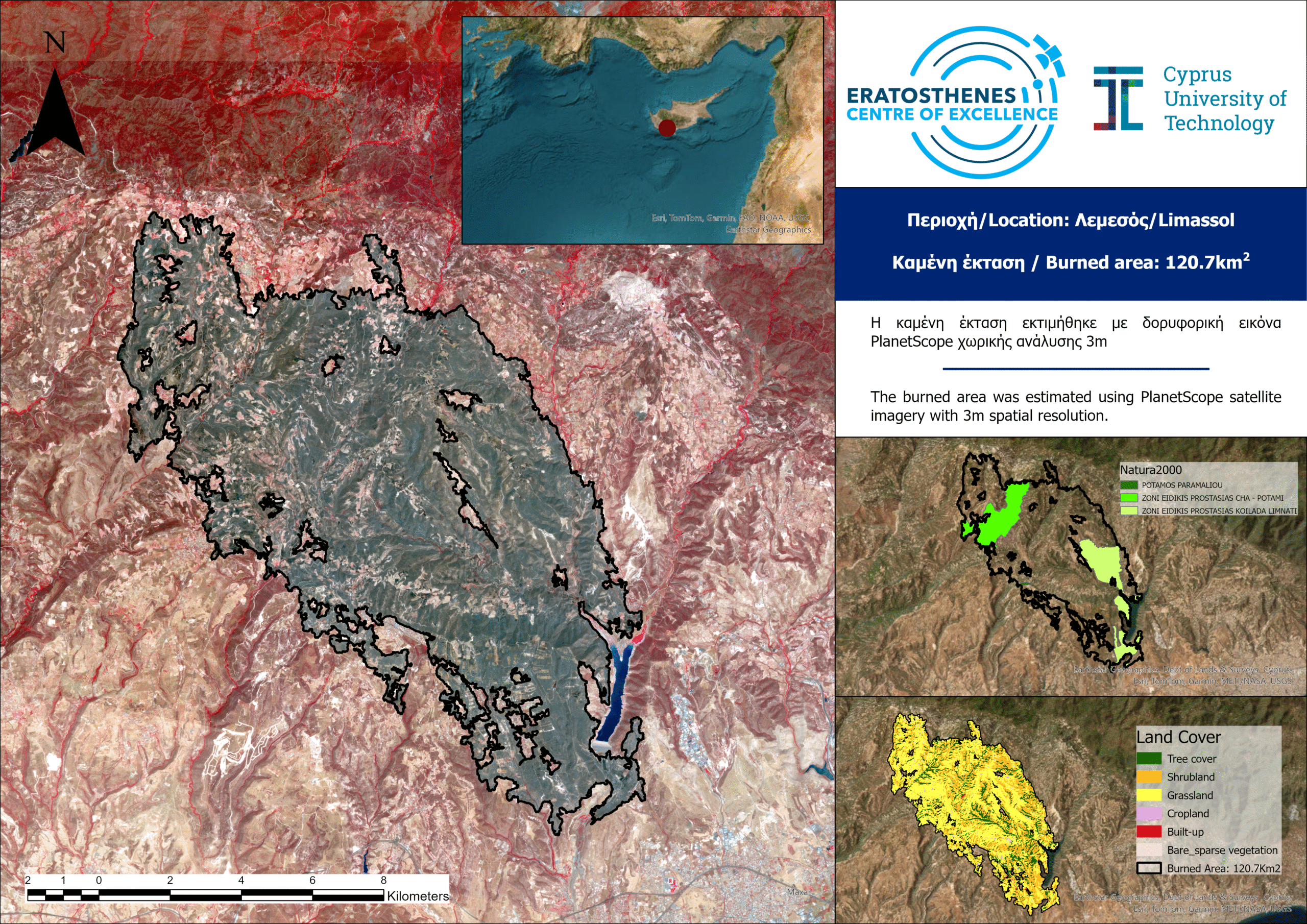
A massive wildfire that swept through Cyprus’ Limassol district last week has scorched more than 120 square kilometers, according to new satellite analysis released by the ERATOSTHENES Centre of Excellence.
The fire, which broke out on July 23, burned an area equal to about 1.3% of the island nation’s total landmass, making it one of the most destructive blazes in recent years. Researchers said the loss will have lasting impacts on biodiversity, natural heritage and local communities, with recovery expected to take decades.
The damage assessment was based on high-resolution satellite data from the PlanetScope constellation, captured July 26.
Data from the European Space Agency’s WorldCover program showed that grasslands made up 51% of the burned area, followed by shrubland at 31%, forested areas at 15.5% and residential zones at 1.1%.
Environmental officials said the fire also burned through protected sites within the Natura 2000 network, including the Paramaliou River, Cha-Potami and Limmati Valley special protection areas.
With information from eratosthenes.org.cy.